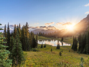
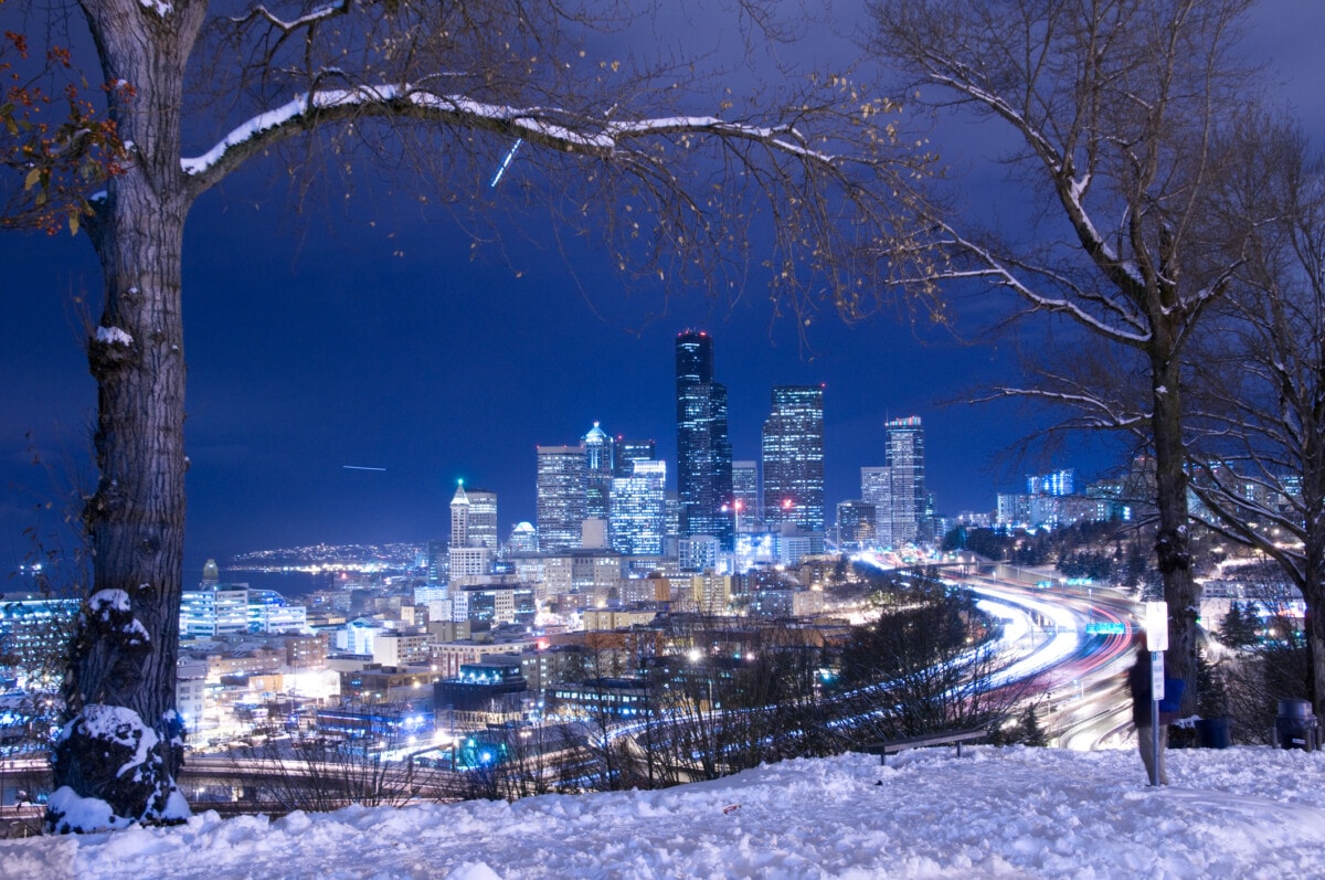
Washington boasts coastal beauty, varied landscapes, and diverse climates ranging from rainy floodplains to glaciated peaks. Influenced by the Pacific Ocean and Cascade Mountains, the western part of the state is wetter and milder, while the east is drier before becoming green and forested in the southeast.
No matter where you live in Washington, though, you are at risk of natural disasters, such as wildfires, flooding, landslides, and more. When these happen, it’s essential to be prepared.
So what are the most common natural disasters in Washington, how are they changing, and what can you do to prepare? Whether you’re planning a move to Seattle or are looking at apartments in Spokane, read on for everything you need to know.
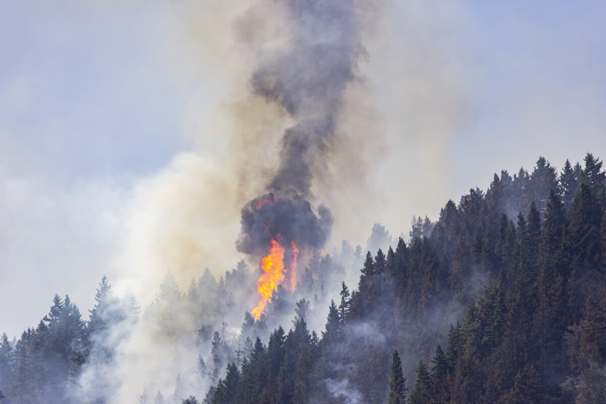
1. Washington wildfires
Washington cities most at risk of wildfires
- Wenatchee: 51% of properties at risk
- Yakima: 43% of properties at risk
- Kennewick: 33% of properties at risk
Wildfires are a major natural disaster in Washington. In just the past five years, wildfires have cost the state more than $153 million per year, which is more than six times the cost of 10 years ago.
Fires can happen throughout the state, but they’re more common in Eastern Washington and around the Cascades. Fires impact homeowners, too; according to data from First Street Foundation, 1.6 million properties (52%) are at risk of being affected by a wildfire in the next 30 years. Fires can also dramatically impact air quality for the entire state’s population (7.8 million people).
The state’s fire season is typically from June to September, but it’s growing longer and varies depending on snowpack, rainfall, and temperatures. While historically not a major issue, wildfires have become increasingly destructive and are projected to get worse due to climate change. Moreover, 50 years of fire suppression has created dry, overgrown forests, which are primed to burn. The most recent large fire was the 2020 Whitney Fire, which burned more than 130,000 acres near Spokane.
Wildfires also increase the area’s vulnerability to flooding, landslides, mudslides, and drought. This is because fires burn tree cover, which reduces seasonal snowpack and harms watersheds.
How to prepare for wildfires in Washington
As Washington wildfires grow, preparing for them is more essential than ever. Here are some tips to help:
- Stay updated on fire weather forecasts, look at an interactive map, and follow all fire restrictions.
- Create a defensible space around your property.
- Prepare for poor air quality by purchasing an air purifier and installing HEPA air filters on air conditioning units.
- Install interior and exterior sprinkler systems, if you have access to enough water and drought restrictions don’t prohibit it.
- Install a generator to keep the power running in case of power outages.
- Build a fireproof and waterproof emergency kit with food, water, clothing, shelter, and valuable documents.
- Ensure your insurance adequately covers fire damage, or understand the risks of going uninsured.
- Work with your community. This is the most successful way to mitigate fire risk in your neighborhood.
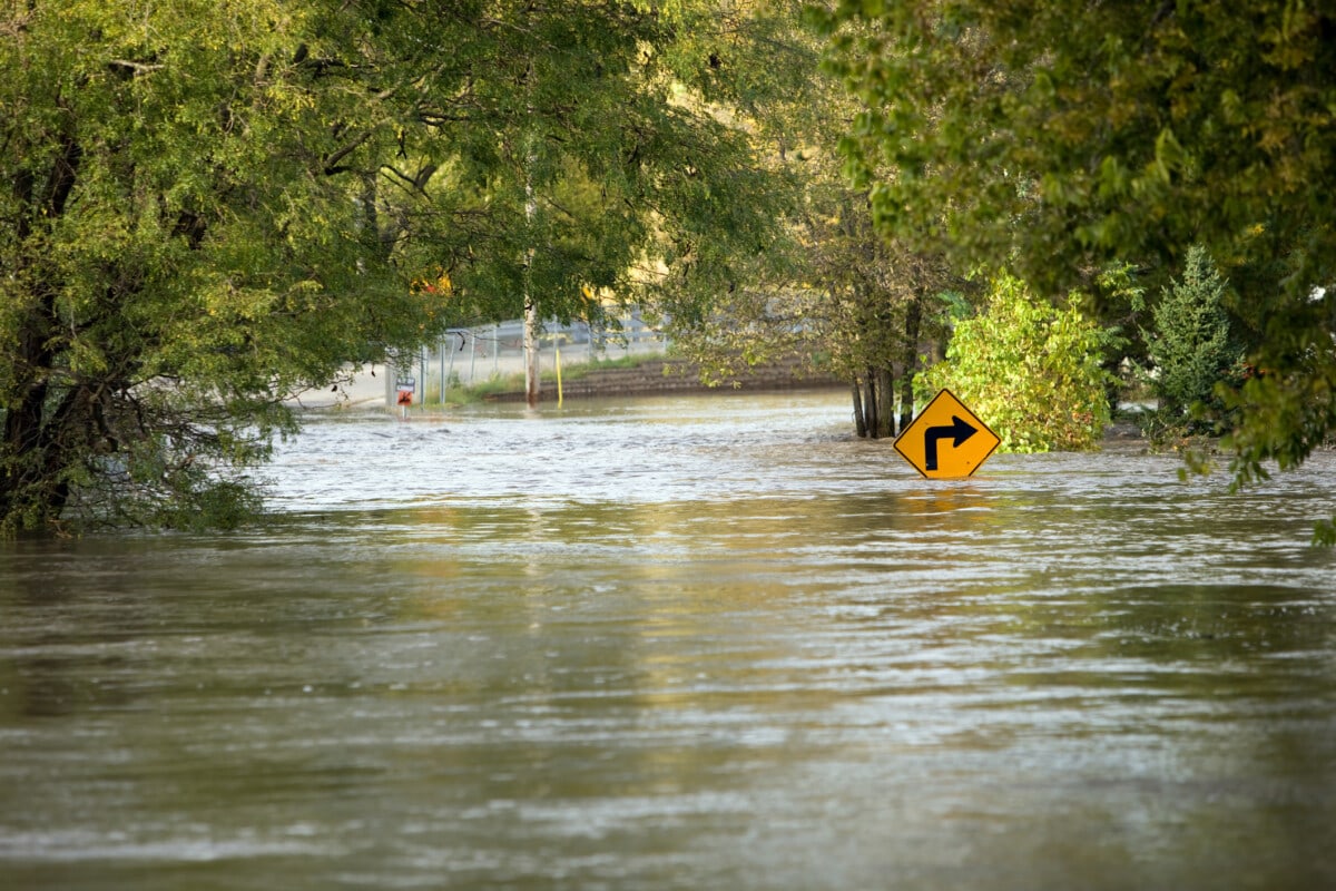
2. Washington flooding
Washington cities most at risk of flooding
- Longview: 43% of properties at risk
- Aberdeen: 33% of properties at risk
- Ellensburg: 30% of properties at risk
Washington is extremely prone to flooding, especially around the Puget Sound. This is because much of the region is a floodplain, with many rivers draining snowmelt and rainfall from the mountains. Most flooding in the state is due to riverine flooding from heavy rainfall and snowmelt. Some major rivers, especially the Snoqualmie River, are expected to flood every year.
Washington usually experiences flooding from October through April, with November being the most common month. The state has had 32 disaster declarations since 1950 due to flooding, which has affected every county and thousands of homeowners. In fact, the cost of flooding in Washington is greater than all other natural hazards. First Street Foundation estimates that 14% of properties have a severe chance of being flooded in the next 30 years.
Flooding in Washington is especially dangerous because it’s most common near major urban centers, most of which sit next to the Puget Sound or a large river. Flooding is expected to get worse as climate change progresses; rainfall will be less frequent but more intense, king tides will get higher, and snow will melt more quickly.
How to prepare for flooding in Washington
In Washington, preparing for a flood is essential. Here are a few tips to help:
- Familiarize yourself with flood risk maps for your area to see your potential risks.
- Understand your local flood and tsunami evacuation routes.
- Sign up for the King County Flood Warning System and download the Flood Warning app.
- Purchase flood insurance if you’re in a high-risk zone and can afford it.
- Invest in flood sensors.
- Stay tuned to weather forecasts and alerts, and have a communication plan in place with your family.
- Elevate valuable items in flood-prone areas of your home, and install sandbags or barriers if necessary.
- During and after heavy rainfall, be on the lookout for landslides and mudslides.
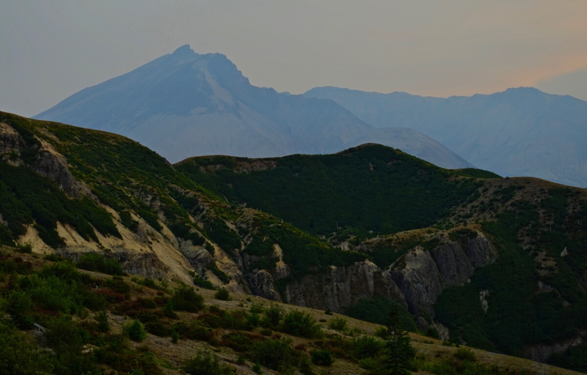
3. Washington landslides
Landslides are a major risk in Washington. In fact, Washington is one of the most landslide-prone states in the country, seeing hundreds of events every year. Factors such as heavy rainfall, earthquakes, rapid snowmelt, and even construction or excavation can trigger landslides. Most landslides are caused by excessive rain and snowmelt.
Additionally, many parts of Washington are at a higher risk of landslides and mudslides due to more severe fires followed by heavier rains, though this is more pronounced in California. Wildfire-fueled landslides can also be more dangerous due to excessive debris. As Washington’s fire season gets longer and the rainy season gets shorter but more intense, this is expected to worsen
Most landslides occur near the Cascades, Olympic Mountains, and on the coast. However, all major cities are at risk of landslides, including Seattle, where 8% of the city’s surface is at risk of sliding.
How to prepare for landslides in Washington
The most important part of preparing for a landslide is thinking ahead and familiarizing yourself with the landscape. Importantly, don’t build a home or structure near steep slopes, close to mountain edges, or along natural erosion valleys. Here are some additional tips to help:
- Review areas at risk using the Washington State interactive hazards map.
- Check if your property has been affected by landslides in the past, as these areas are most at risk.
- Consult a professional for retrofitting, such as flexible pipe fittings.
- Plant ground cover on slopes, and build retaining walls around your property.
- Build channels or deflection walls to direct mudflow around your home. However, if you direct debris into a neighbor’s property, you may be liable for damages.
- Consider purchasing landslide insurance, as standard homeowners insurance policies generally don’t cover damage from landslides or mudslides.
- Stay alert during periods of heavy rain or seismic activity.
- Recognize warning signs, such as new or widening cracks in your home’s structure, bulging ground, or unusual sounds.
4. Washington heat waves
Washington cities most at risk of heat waves
- Kennewick: 75% of properties at risk
- Walla Walla: 24% of properties at risk
- Yakima: 22% of properties at risk
Washington is known for its mild and wet weather, but it’s becoming increasingly prone to extreme heat waves. First Street Foundation estimates that 3 million properties (60% of the population) are at some level of heat risk. Eastern Washington is more at risk, but Western Washington’s risk is growing more quickly.
While the state doesn’t experience very many “dangerous” heat days, temperatures have frequently risen beyond the “Local Hot Day” mark, meaning they were hotter than 98% of days that year. Heat waves can push temperatures even further to over 100 degrees.
Heat waves in Washington are particularly dangerous because many people don’t have air conditioning, primarily in Western Washington. This was evident during the record-breaking heat wave in 2021, where temperatures in Seattle exceeded 100 degrees for three days in a row, topping out at 108 degrees.
Washington is also susceptible to marine heat waves, which can also cause additional heat-related effects on the land, especially during El Niño years (when the tropical Pacific Ocean is warmer.)
How to prepare for heat waves in Washington
Heat risk in Washington can be intense during heat waves, primarily in the summer and early fall. Here are a few ways to stay cool in extreme heat:
- Stay updated on forecasts and advisories to prepare for a heatwave.
- Close blinds, shades, and curtains.
- Purchase air conditioning if you can, or find a location that does.
- Prepare a meal plan that doesn’t involve cooking indoors
- Install a generator in case the power goes out due to strained utility systems.
- Stay hydrated before, during, and after a heat event, especially near the more humid coast.
- Limit outdoor activities to the early morning and late evening.
- If your home is above 95 degrees and you don’t have AC, don’t use a fan to cool yourself down.
5. Washington winter storms
Washington winters are generally mild and wet, especially west of the Cascades. Most of the state sees some snowfall every year, though, and storms can create hazardous conditions. In February 2019, Seattle and surrounding areas received a series of storms that dropped snow for over a week, breaking numerous records. And in 2022, an ice storm hit the area, causing widespread disruptions.
In Washington, snowstorms often come from atmospheric rivers hitting the Cascade mountains. They can also come from a combination of cold arctic air paired with rain from the Pacific. Snow in Central and Eastern Washington is much more common because temperatures are generally lower in the winter.
Winter storms are especially dangerous west of the Cascades because cities don’t have the infrastructure to handle them. For example, a storm dropping a foot of snow in Seattle would cause the city to shut down, but in Spokane, it would be a fairly normal day.
As climate change persists, rain and snow will fall less frequently but more intensely, leading to more precipitation in shorter bursts. Whether this is in the form of rain or snow, it will likely lead to more damaging winter storms.
How to prepare for winter storms in Washington
Preparing for severe winter weather events helps ensure your safety and minimizes impact on your home and family. Here are a few tips to help you prepare for winter:
- Winterize your home by inspecting your roof, clearing gutters, cleaning your chimney, insulating your attic, checking your heating system, and insulating your pipes.
- If winter weather includes an ice storm, take extra precautions, such as using snow-melting salt or pellets on your walkways and driveway, clearing your gutters, and covering trees to prevent them from falling.
- Update your emergency kit to include extra warmth.
- Keep a supply of firewood or alternative heating sources in case the power goes out.
- Charge or refuel your vehicle, and equip it with chains, extra blankets, a shovel, and emergency supplies.
- Prepare alternate travel routes, as storms often cause closures of mountain passes and create hazardous conditions.
- Stay updated on weather forecasts and make sure you have a reliable method of communication.
6. Washington earthquakes
Earthquakes, although infrequent, are a major risk in Washington. The state is home to thousands of fault lines, many directly underneath cities. Western Washington is the most at risk of earthquakes, but most of the state is vulnerable.
Despite the low daily risk, earthquakes have the potential to wreak havoc when they strike, especially in large cities. Compared to California, though, Washington experiences relatively few daily earthquakes. The last major earthquake to directly affect the state was the Nisqually quake in 2001, which caused around $4 billion in damages across the Puget Sound and prompted new earthquake regulations.
Many Washingtonians are also aware of the next “Big One,” which is predicted to occur along the 620-mile Cascadia Subduction Zone (CSZ) within the next century. This earthquake will likely be over Magnitude 9 and cause widespread damage along the entire region west of Interstate 5 and beyond.
How to prepare for earthquakes in Washington
Earthquakes are irregular but destructive and can cause significant damage to structures, utilities, and water systems. Main shocks can last for minutes, while aftershocks can last for years. They can also strike suddenly, at any time, with only seconds of warning, so preparing your home is critical. Here are a few tips to help:
- Purchase earthquake insurance to cover some losses in the event of a quake. This is a separate policy that you purchase in addition to regular homeowners’ or renters insurance.
- Ensure your home is prepared for an earthquake. If you live in a house built before 1980, it will likely need to be retrofitted, including being bolted to its foundation. Don’t do this yourself; hire a seismic retrofitting professional.
- Download an early alert warning app.
- Keep a durable, charged communication device readily available.
- Practice drop, cover, and hold on, so you are ready when a quake hits.
- If you live near the coast, you should also prepare for a possible tsunami following an earthquake.
Final thoughts on natural disasters in Washington
Climate change has altered Washington’s climate dramatically, and will continue to in the years to come. In addition to flooding, wildfires, and heat waves, droughts are also becoming more common and widespread, especially in the summer. The state is taking an active role in mitigating disasters, but more work is necessary.
If you’re considering moving to Washington or already call the Evergreen State home, make sure you’re prepared for natural disasters. Understanding your risks and adequately preparing are helpful to make the most out of living in Washington. The National Weather Service and the Washington State Government offer experimental maps that show forecasted and possible risks in any given area, which can help you prepare.
Lastly, many natural disasters are worsened by climate change. So no matter how you prepare, reducing your carbon footprint and fighting for systemic change are the best long-term solutions.
“At risk” means a property has a major or greater probability of being affected by a certain risk in the next 30 years. State and metro data is courtesy of First Street Foundation.
This article is for informational purposes only. Individual results may vary. This is not intended as a substitute for the services of a licensed and bonded home services or disaster prevention professional. Always seek expert advice and follow all official guidance before, during, and after a disaster.
The post Natural Disasters in Washington: What Homeowners and Renters Need to Know appeared first on Redfin | Real Estate Tips for Home Buying, Selling & More.